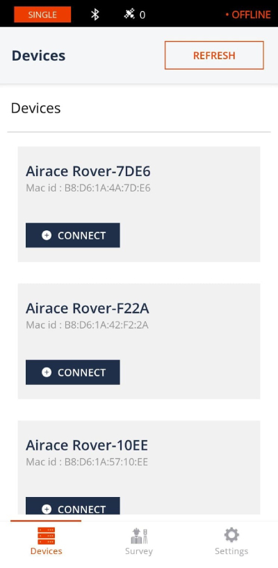
With Airace One, effortlessly Deploy Activate Setup
the GNSS receiver and start collecting or staking out points
Elevate your GNSS surveying experience with Airace One
Our intuitive Android app designed to streamline your workflow. Seamlessly connect to Airace RTK receivers via Bluetooth, harnessing precise NMEA data while accessing RTCM corrections through NTRIP and LORA Radio.
With Airace One, conducting surveys becomes effortless; mark points with pinpoint accuracy, stake out locations with ease and export your data for further analysis. Whether you're in construction, agriculture, or land surveying, Airace One is your trusted companion for precise GNSS data collection and analysis, empowering you to achieve unparalleled results in the field.
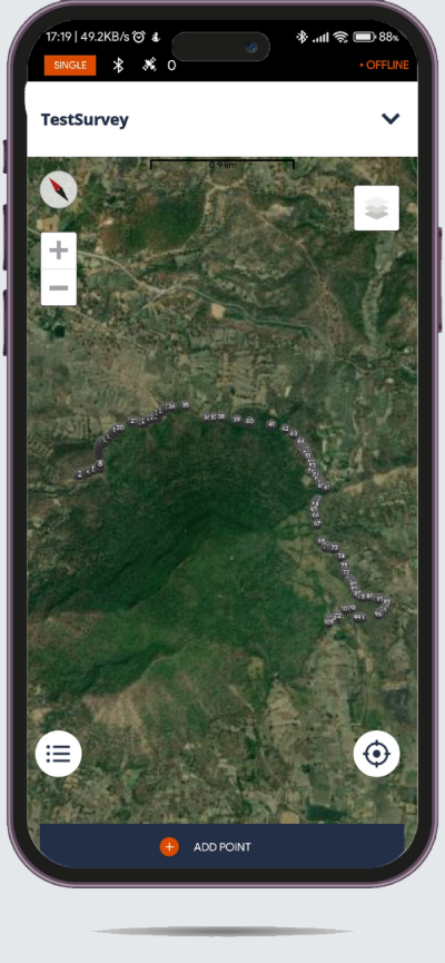
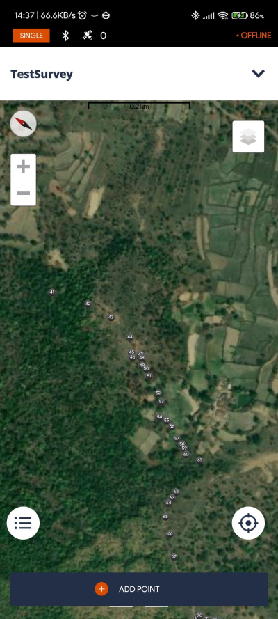
Efficient data collection and stakeout
POINT COLLECTION
Collect points, write detailed descriptions, and perform quality control using our responsive interface. The app has built-in support for projections, grids, and geoids and a library with hundreds of verified coordinate systems.
COORDINATE SYSTEMS WIZARD
Airace One has a wizard for manual coordinate system creation for areas without a predefined coordinate system. To start your survey, you just need to specify the datum, enter transformation parameters or projection, and choose your geoid.
INTUITIVE STAKEOUT TOOL
Airace One displays East-North and straight-to-line distances and supports cut and fill indication. When you get close to a point, the indication switches to a close-up alignment mode helping you to center exactly above the point.
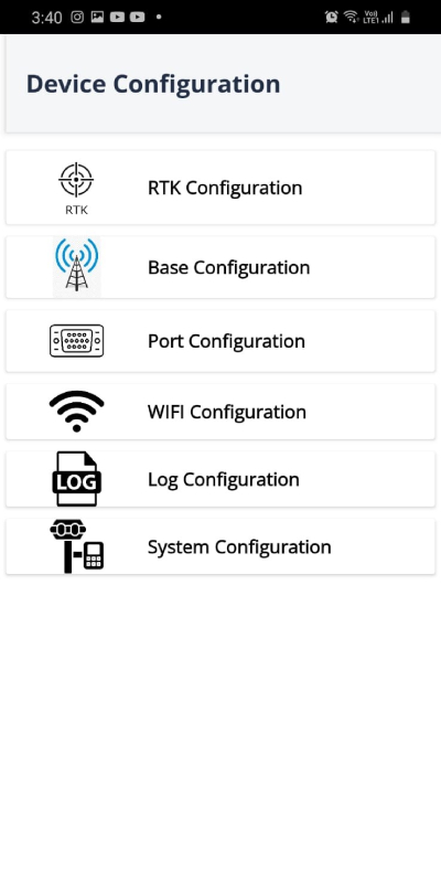
Bluetooth Device Configuration
Discover unparalleled flexibility with Airace's Device Configuration Options. Seamlessly switch between rover and base modes to adapt to your surveying needs on the fly.
Customize your device's WiFi configuration for optimal connectivity in any environment. Fine-tune hardware system settings, log configurations, and port settings with ease, ensuring your device operates exactly as needed.
With RTK configuration capabilities, achieve unparalleled precision in your GNSS surveys. Airace puts the power of customization in your hands, empowering you to tailor your device to meet the demands of any project.
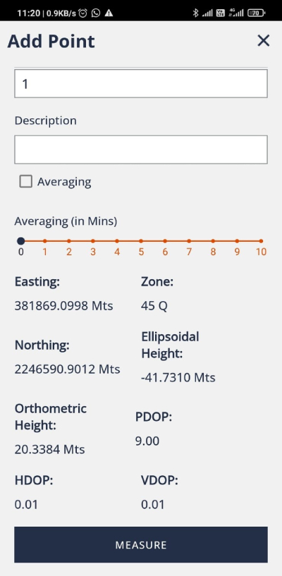
Save Live Point
Airace One enhances your field data collection capabilities. With Airace One, you can instantly save live points directly from your device, capturing crucial data in real-time.
Whether you're conducting surveys, mapping terrain, or monitoring assets, this app ensures that no valuable information is missed. Seamlessly integrate these live points into your projects, enabling efficient decision-making and accurate analysis.
Intuitive Measurement Tool
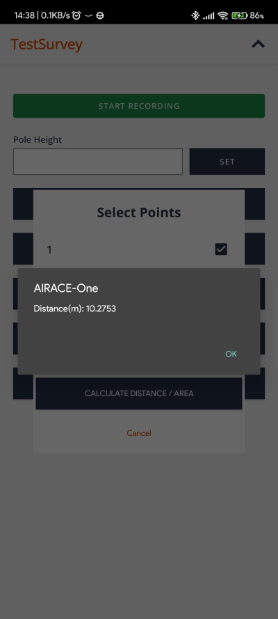
With this intuitive tool, you can effortlessly measure lengths and areas between points with unparalleled accuracy. Whether you're mapping out boundaries, assessing distances, or planning construction projects, the Measurement Tool provides you with the data you need to make informed decisions.
Simply select your starting and ending points, and let the app do the rest. Instantly calculate distances between points or outline areas with ease. With Airace One, you have the power to conduct detailed measurements directly from your device, empowering you to achieve optimal results in every project.
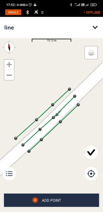
Draw Lines and Polygons
With this versatile tool, you can sketch lines, mark points, and outline polygons effortlessly, unleashing your creativity and enhancing your mapping experience.
Whether you're planning routes, delineating boundaries, or annotating key features, the Drawing Tool offers the flexibility to bring your ideas to life on the map. Simply select your desired drawing mode, and start creating – it's that easy!
With Airace's Drawing Tool, the possibilities are endless. Empower yourself to express your ideas visually and collaborate effectively with stakeholders, making your mapping endeavors more interactive and impactful than ever before.
Seamless Connectivity
Experience seamless integration with Airace RTK receivers through Bluetooth connectivity and NTRIP connection via Airace Catalyst NTRIP caster.
Our innovative technology ensures effortless communication between your device and Airace RTK receivers, facilitating smooth data transmission and enhancing your GNSS surveying experience.
With Airace One, you can trust in reliable connections that enable precise data collection and real-time corrections, empowering you to achieve optimal results in every surveying task.
